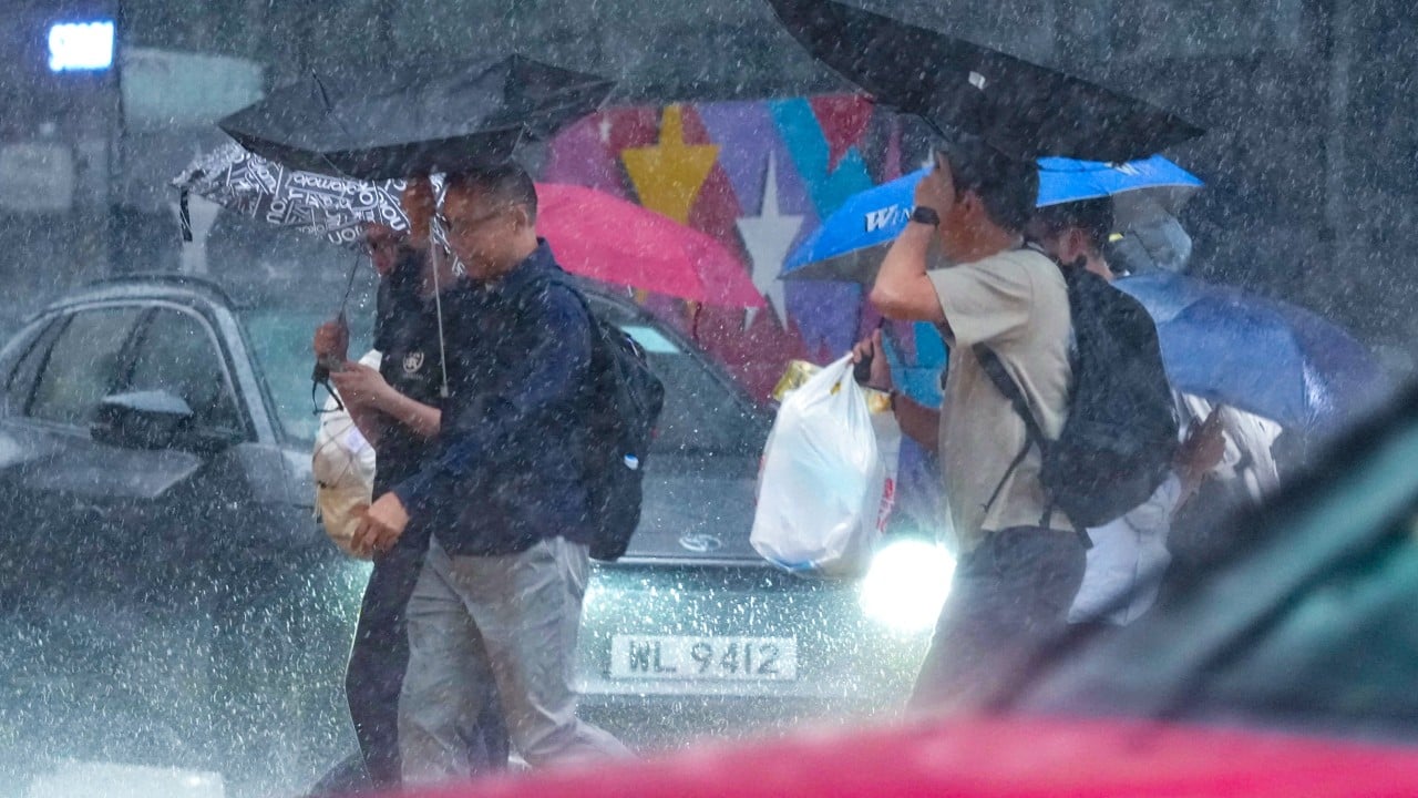
Hong Kong's weather system loves drama, but morning rush hour downpours take the prize for pure chaotic energy. One minute you're stepping out the front door with an umbrella you thought you wouldn't need, and the next, your phone is buzzing with a Red Rainstorm Warning while torrential rain turns the street corner into a fast-flowing stream.
That's exactly what happened when the Hong Kong Observatory escalated an Amber signal to a Red Rainstorm Warning Signal at 7:40 a.m. as an active southwesterly airstream battered the Guangdong coast. Downpours hit over 50 millimetres per hour across several districts, forcing sudden school suspensions and scrambling morning commute plans. Then, less than two hours later at 9:25 a.m., the Observatory downgraded the warning back to Amber as the heaviest convective cloud clusters shifted off.
If you live or work in Hong Kong, this whiplash feels all too familiar. The rapid shift from Amber to Red and back again leaves parents wondering about school closures, office workers debating whether to brave the MTR, and drivers navigating flooded low-lying roads.
Understanding how the system actually works—and why these sudden downgrades happen even when rain continues outside—is the only way to avoid getting caught off guard.
The Science Behind Morning Downpours in the South China Sea
Heavy summer rainstorms in Hong Kong don't usually arrive like slow-moving winter fronts. They explode rapidly.
During mid-summer, an active southwesterly airstream interacts with broad low-pressure troughs sitting over the northern South China Sea. As warm, moisture-laden air streams in from the ocean, it collides with cooler coastal air masses or gets pushed upward by local topography like Tai Mo Shan and Lantau Peak.
When that air rises, it condenses with extreme speed. A minor band of showers floating south of Hong Kong can intensify into intense, localized convective cells within 20 to 30 minutes.
The Hong Kong Observatory tracks these storm cells using Doppler weather radar, automatic weather stations, and satellite imagery. But because atmospheric instability during summer trough patterns is so dynamic, rain rates can swing wildly across remarkably short distances. You might get 60 millimetres of rain in an hour in Shatin while Central gets barely a drizzle, or vice versa.
When the Observatory issues a Red warning, it means heavy rain exceeding 50 millimetres per hour has fallen or is expected to fall generally across Hong Kong, and it is likely to persist. The moment the core of that storm cell weakens or drifts eastward into the Pearl River Estuary, the rainfall rate drops below that critical threshold. That's why downgrades happen quickly—even if light to moderate showers keep coming down.
Breaking Down the Three Tier Rainstorm Warning System
To understand why public communication gets tricky during torrential rain, you have to look at what each colour code legally triggers across the city. The Hong Kong Observatory uses a three-tier heavy rain warning system designed to warn the public of major traffic disruptions, flooding risks, and potential landslides.
| Signal Level | Hourly Rainfall Threshold | Primary City Response | School & Workplace Impact |
|---|---|---|---|
| Amber Signal | Exceeds 30 mm/hr generally | High alert for flooding in low-lying areas | Classes operate as normal; outdoor activities adjusted |
| Red Signal | Exceeds 50 mm/hr generally | Flash flood precautions; emergency departments ready | AM and whole-day school classes suspended |
| Black Signal | Exceeds 70 mm/hr generally | Emergency services on full deployment; major transit alerts | All schools suspended; stay indoors; work generally halted |
The problem for most residents isn't understanding the colours. It's the timing of the announcements relative to the morning rush hour.
The School Closure Dilemma and the 10:30 Rule
When the Observatory raised the Red signal at 7:40 a.m., the Education Bureau immediately announced the suspension of morning-session and whole-day schools. But by 7:40 a.m., thousands of children were already on school buses, walking down footbridges, or sitting in school halls.
This creates a high-stress puzzle for parents and school administration teams.
Under Education Bureau guidelines, schools are required to keep their doors open and implement contingency measures for any students who arrive on campus during bad weather. School staff must care for these children until conditions are safe for them to return home. Parents are specifically instructed not to panic or rush through heavy downpours to pick up their kids immediately.
The downgrade to Amber at 9:25 a.m. triggered another specific policy requirement. Because the Red warning was cancelled before 10:30 a.m., afternoon-session schools resumed classes as normal.
If you are a parent managing this chaos, keep three ground rules in mind:
- Never make a sudden dash to school during a Red or Black signal; your child is already inside a protected building.
- Keep the official Hong Kong Observatory mobile app alerts switched on for push notification updates.
- Trust the school's emergency intake plan rather than third-party chat groups that spread outdated rumors.
Why Workplaces Handle Rainstorm Signals Differently
While school closures follow strict, standardized rules set by the Education Bureau, offices and private businesses follow Labour Department guidelines—and those come with more flexibility depending on your employer.
Under Labour Department recommendations, employees are generally expected to stay indoors or seek safe shelter during Red and Black Rainstorm Warnings. If a Red signal is raised while you are already at work, you should stay inside the office unless there is an immediate physical risk to the building.
If a Red warning is raised before your normal working hours begin, employers are advised not to require staff to travel to work until the signal is downgraded or cancelled. However, once the Observatory downgrades the signal to Amber, the standard expectation is that employees should return to their workplaces within two hours, provided safety conditions allow.
This requirement creates friction. Roads may still suffer from localized flooding, MTR station entrances might experience brief overcrowding, and bus routes often face severe delays due to accumulated runoff.
Knowing your employer's specific extreme weather policies before the storm season hits saves you from making unsafe decisions on flooded streets.
Common Flash Flood Hotspots You Should Avoid
Heavy downpours don't affect every corner of Hong Kong equally. The city's steep topography and dense urban build-out mean that water flows down slopes rapidly into low-lying coastal and valley areas.
During an Amber or Red rainstorm, certain locations carry a heightened risk of localized flooding and sudden surface runoff:
Northern New Territories Rural Lowlands
Areas around Sheung Shui, San Tin, and Pat Heung sit on low-lying floodplain terrain. When drainage channels overflow, water quickly accumulates in village areas and agricultural plots.
Urban Coastal Corridors
Districts like Eastern Island, Kowloon City, and parts of Mong Kok can experience temporary pooling when intense rainfall coincides with high tide levels, slowing down storm drain discharge into Victoria Harbour.
Mountain Access Roads and Hiking Routes
Wong Nai Chung Gap, Tsuen Wan Elevated Roads, and mountain passes across Lantau Island face severe surface runoff risks. Small streams along popular hiking trails can transform into dangerous flash floods in less than fifteen minutes.
If you find yourself near watercourses or low-lying underpasses during heavy rain, step away immediately. Flash floods move faster than most people expect, carrying debris that can easily knock an adult off their feet.
How to Prepare for Unsettled Weather Ahead
When a broad trough of low pressure lingers over the Guangdong coast, rainstorms rarely vanish after a single morning downpour. Unsettled weather patterns often persist for several days, bringing sporadic squalls and sudden bursts of thunder.
To stay safe and minimize disruption to your schedule, take these practical steps today:
- Check the official HKO app every night before bed and as soon as you wake up during trough conditions. Look closely at the radar imagery, not just the temperature icon.
- Keep a dry change of clothes and spare footwear at your workplace. Walking through knee-deep urban runoff in wet socks makes for a miserable work day.
- Review your family's contingency protocol for school transport. Make sure your children know who will pick them up if morning classes are suspended mid-transit.
- Inspect your residential drainage points. Clear dead leaves and debris from balcony drains and window troughs to prevent indoor flooding during sudden cloudbursts.
- Avoid water sports, mountain hiking, and coastal strolls until the Observatory completely cancels all active weather warnings and squally thunderstorm alerts.
Unsettled weather is an unavoidable feature of summer along the South China Sea. Being prepared for sudden signal changes keeps you safe, calm, and dry when the skies open up.